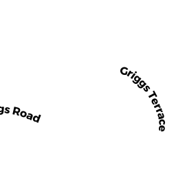
11 GRIGGS TER
Owner Information
ECKEL MALCOLM D
11 GRIGGS TER
BROOKLINE, MA 02446


Property Details
11 GRIGGS TER is classified as a Two-Family Residential (Row end).
The primary structure on this property was built in 1908. There is 3,442ft2 of residential/living space within this property. This property is listed as having 10 rooms. There are 2 units within this property.
11 GRIGGS TER is valued at $2,094,800. The land is valued at $731,500 and the structures are valued at $1,363,300.
This property is in Zone T-6. Confirm with local Zoning Board authorities to ensure there are no overlays or other easements on this property.
The most recent deed for 11 GRIGGS TER is recorded at the local registrar in Book 11424, Page 446. 11 GRIGGS TER was last sold on Tuesday, July 2, 1996 for $481,400.
Assessment data from fiscal year 2021.
Flood Data
According to the FEMA National Flood Hazard Layer, this property does not appear to be in a flood zone. It may also be in an area not yet reviewed. Nonetheless, confirm this information prior to taking any action.
To view the flood hazards around this property, create a FEMA "Firmette" Map of the area around 11 GRIGGS TER.
Broadband Internet Providers
| Provider | Type | Bandwidth (mbps) | |
|---|---|---|---|
| Comcast | Cable | 1000 | 35 |
| Starry, Inc. | Fixed Wireless | 200 | 200 |
| RCN | Cable | 1000 | 20 |
| VSAT Systems, LLC. | Satellite | 2 | 1 |
| HughesNet | Satellite | 25 | 3 |
| GCI Communication Corp. | Satellite | 0 | 0 |
| Verizon New England Inc. | DSL | 15 | 1 |
| Viasat Inc | Satellite | 100 | 3 |
| RCN | Cable | 500 | 20 |
| netBlazr Inc | Fixed Wireless | 50 | 50 |
Broadband service provider data from December 2020.
Adjacent Properties
- 1443 BEACON ST
Mixed Use (Primarily Residential, some Commercial) owned by 1443 BEACON LLC - 12 12A GRIGGS TER
Two-Family Residential owned by HERTZ KENNETH - 1459 BEACON ST
Rooming and Boarding Houses owned by PAPPAS CYNTHIA - 10 GRIGGS TER
Single Family Residential owned by SMITH KEVIN P - 1455 BEACON ST
Apartments with More than Eight Units owned by METROPOLE BEACON LLC